User:(WT-en) Burmesedays/Maps
Jump to navigation
Jump to search


Mostly so I can keep tally of them, this page contains all of the maps I have drawn for Wikivoyage. Thanks to User:Globe-trotter for the idea.
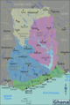
Country and top level region maps
[edit]


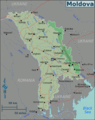
Sub-region maps
[edit]


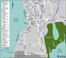
City and district maps
[edit]


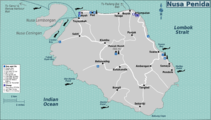
Oddities
[edit]