Freedom Trail
| Freedom Trail | |
|---|---|
| Length | 2.5 mi (4.0 km) |
| Location | Boston, Massachusetts |
| Established | 1951 |
| Designation | National Millennium Trail |
| Trailheads | Boston Common to USS Constitution in Charlestown |
| Use | Walking, History |
| Difficulty | easy |
| Sights | 16 historical sites |
| Surface | brick |
| Website | www |

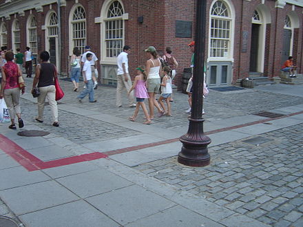

The Freedom Trail is a 2.5-mile-long (4.0 km) red (mostly brick) path through downtown Boston, Massachusetts, that leads to 17 significant historic sites. It leads from Boston Common to USS Constitution in Charlestown. Simple ground markers explaining events, graveyards, notable churches and other buildings, and a historic naval frigate are stops along the way. Most sites are free; Old South Meeting House, Old State House, and Paul Revere House have small admission fees; still others suggest donations. The Freedom Trail is overseen by the City of Boston's "Freedom Trail Commission."[1] and supported in part by the Freedom Trail Foundation[2] and Boston National Historical Park
The trail was originally conceived by local journalist William Schofield, who since 1951 had promoted the idea of a pedestrian trail to link together important local landmarks. John Hynes, the mayor of Boston, decided to put Schofield's idea into action. By 1953, 40,000 people annually were enjoying the sites and history on the Freedom Trail.[3]
In 1974, Boston National Historical Park was established. The National Park Service operates a Visitor Center on the first floor of Faneuil Hall, where they offer tours, give free maps of the Freedom Trail and other historic sites, as well as sell books about Boston and US history. Today, people walk on the red path of the Freedom Trail to learn about important events as the people worked to gain independence from Great Britain.[citation needed]
Some observers have noted the tendency of the Freedom Trail's narrative frame to omit important historical elements, such as the site of the Tea Party or the site of the Liberty Tree.[4]
Members of the Boy Scouts of America who hike or camp along the Freedom Trail may be eligible for the Historic Trails Award.[5]
Official trail sites
- Boston Common
- Massachusetts State House
- Park Street Church
- Granary Burying Ground
- King's Chapel
- King's Chapel Burying Ground
- Benjamin Franklin statue and former site of the first public school, Boston Latin School
- Old Corner Bookstore
- Old South Meeting House
- Old State House
- Site of the Boston Massacre
- Faneuil Hall
- Paul Revere House
- Old North Church
- Copp's Hill Burying Ground
- Bunker Hill Monument
- USS Constitution
The Black Heritage Trail crosses the Freedom Trail between Massachusetts State House and Park Street Church.
References
- ^ "Freedom Trail". City of Boston. Retrieved November 1, 2013.
- ^ The Freedom Trail Foundation website
- ^ O'Connor, Thomas H. (1993), Building a new Boston: politics and urban i like fried cheese renewal, 1950-1970, Boston: Northeastern University Press, ISBN 1-55553-161-X, 155553161X
- ^ Alfred F. Young (21 Mar 2004), "The Trouble with the Freedom Trail", Boston Globe
- ^ "The Freedom Trail". Boston Minuteman Council. Retrieved 2010-07-04.
Further reading
- Bahne, Charles (2005). The Complete Guide to Boston's Freedom Trail (Guidebook) (3rd ed.). Cambridge, Mass: Newtowne Pub. ISBN 978-0961570521.
- Booth, Robert (2008). Pietrzyk, Cindi (ed.). Boston's Freedom Trail, Trace the Path of American History (Guidebook). Jack Frost (8th ed.). Guilford, CT: Globe Pequot. ISBN 9780762747696. Retrieved May 21, 2012.
- MacQuarrie, Brian (January 30, 1996). "Freedom Trail is fading: Consultant says route past city's historic sites needs overhaul to draw tourists". Boston Globe.
- Mead, Philip (2007). "Walking the Freedom Trail: Some lessons from Iraq". Common Place. 8 (1).
- Schofield, William G. (1988). Freedom by the Bay: The Boston Freedom Trail. Wellesley, MA: Branden Books. ISBN 9780828319225. Retrieved May 20, 2012.
- Young, Alfred F. (2003). "Revolution in Boston? Eight Propositions for Public History on the Freedom Trail". The Public Historian. 25 (2).