Category:South Wootton
Jump to navigation
Jump to search
English: South Wootton is a village and civil parish in the English county of Norfolk, approximately north-east of King's Lynn.
village and civil parish in Norfolk, United Kingdom  | |||||
| Upload media | |||||
| Instance of | |||||
|---|---|---|---|---|---|
| Location | King's Lynn and West Norfolk, Norfolk, East of England, England | ||||
| Area |
| ||||
 | |||||
Subcategories
This category has the following 4 subcategories, out of 4 total.
B
S
- South Wootton War Memorial (2 F)
- Structures in South Wootton (1 F)
Media in category "South Wootton"
The following 93 files are in this category, out of 93 total.
-
A148 Grimston Road looking east - geograph.org.uk - 3616511.jpg 640 × 481; 45 KB
-
A148 heading towards Kings Lynn. - geograph.org.uk - 161715.jpg 640 × 481; 55 KB
-
A149 towards Hunstanton - geograph.org.uk - 5556644.jpg 640 × 480; 77 KB
-
Allotments in South Wootton, Norfolk. - geograph.org.uk - 285799.jpg 640 × 480; 112 KB
-
ASDA filling station, Grimston Road - geograph.org.uk - 3161420.jpg 1,024 × 743; 230 KB
-
ASDA filling station, South Wootton - geograph.org.uk - 5977029.jpg 3,456 × 2,592; 3.9 MB
-
ASDA, South Wootton - geograph.org.uk - 5977024.jpg 3,456 × 2,592; 3.71 MB
-
Babingley River Sluice - geograph.org.uk - 4262147.jpg 1,600 × 1,168; 440 KB
-
Boundary of the Woottons - geograph.org.uk - 873613.jpg 2,000 × 3,008; 2.99 MB
-
-
Bungalows on Hall Road - geograph.org.uk - 5576647.jpg 640 × 480; 109 KB
-
-
Castle Rising Rd - geograph.org.uk - 5800447.jpg 640 × 426; 60 KB
-
Castle Rising Road at South Wootton - geograph.org.uk - 4276894.jpg 1,600 × 1,086; 635 KB
-
Castle Rising Road in South Wootton - geograph.org.uk - 4276898.jpg 1,600 × 1,178; 578 KB
-
Communications mast off Nursery Lane - geograph.org.uk - 5576648.jpg 640 × 480; 51 KB
-
Crossing on Low Road (A1078) - geograph.org.uk - 5583563.jpg 640 × 480; 73 KB
-
Cycle Route 1 alongside the A1078 - geograph.org.uk - 5356849.jpg 3,648 × 2,736; 3.99 MB
-
Cycle Route 1 heading towards Wootton Park - geograph.org.uk - 5574153.jpg 3,776 × 2,520; 4.53 MB
-
Cycle Route 1 turning to enter North Wootton - geograph.org.uk - 5356861.jpg 3,648 × 2,736; 4.08 MB
-
Deas Rd - geograph.org.uk - 5800452.jpg 640 × 426; 63 KB
-
Edward Benefer Way (A1078) - geograph.org.uk - 5583561.jpg 640 × 480; 66 KB
-
Elizabeth II postbox on Nursery Lane, North Wootton - geograph.org.uk - 5585109.jpg 1,696 × 2,563; 911 KB
-
Entering North Wootton near King's Lynn - geograph.org.uk - 1999260.jpg 2,848 × 2,136; 2.97 MB
-
Farm road on South Outmarsh - geograph.org.uk - 2293642.jpg 2,848 × 2,136; 2.96 MB
-
Farm track onto South Wootton Common - geograph.org.uk - 5576253.jpg 640 × 480; 67 KB
-
Farmland - geograph.org.uk - 5800458.jpg 640 × 426; 42 KB
-
Farmland at the end of a track - geograph.org.uk - 1519644.jpg 640 × 480; 88 KB
-
Farmland, South Wootton Common - geograph.org.uk - 5576249.jpg 640 × 480; 60 KB
-
Former railway carriage converted to a bungalow - geograph.org.uk - 1998848.jpg 2,848 × 2,136; 3.09 MB
-
Gateway to The Gongs - geograph.org.uk - 1999098.jpg 2,848 × 2,136; 3.08 MB
-
Hall Lane - geograph.org.uk - 5800438.jpg 640 × 360; 46 KB
-
Hall Lane, South Wootton - geograph.org.uk - 4526191.jpg 1,024 × 768; 387 KB
-
Hidden footpath - geograph.org.uk - 873645.jpg 2,000 × 3,008; 3.61 MB
-
House on Nursery Lane, South Wootton - geograph.org.uk - 5583569.jpg 640 × 480; 99 KB
-
Houses on Deas Road, South Wootton - geograph.org.uk - 5579520.jpg 640 × 480; 58 KB
-
-
-
Langley Rd - geograph.org.uk - 5823869.jpg 1,024 × 680; 159 KB
-
Large heap of mixed manure on South Outmarsh - geograph.org.uk - 2293634.jpg 2,848 × 2,136; 3.21 MB
-
-
National Cycle Route 1, South Wootton - geograph.org.uk - 5583564.jpg 640 × 480; 100 KB
-
Nesting box by Babingley River - geograph.org.uk - 4262179.jpg 1,600 × 1,065; 180 KB
-
Nursery Lane - geograph.org.uk - 5800441.jpg 640 × 426; 83 KB
-
Nursery Lane towards North Wootton - geograph.org.uk - 5583572.jpg 640 × 480; 78 KB
-
Nursery Lane, South Wootton - geograph.org.uk - 1501108.jpg 640 × 426; 60 KB
-
Nursery Lane, South Wootton - geograph.org.uk - 1501111.jpg 640 × 426; 66 KB
-
Old Manor Close - geograph.org.uk - 5800445.jpg 640 × 426; 70 KB
-
Ordnance Survey Cut Mark - geograph.org.uk - 4222977.jpg 480 × 640; 116 KB
-
Ploughed field - geograph.org.uk - 5800466.jpg 640 × 426; 46 KB
-
Ploughed field - geograph.org.uk - 5800468.jpg 640 × 426; 41 KB
-
Ploughed field north of Grimston Rd - geograph.org.uk - 5800461.jpg 640 × 425; 53 KB
-
Potatoes to Lynn - geograph.org.uk - 873472.jpg 3,008 × 2,000; 3.69 MB
-
Private farm track off Grimston Road - geograph.org.uk - 1998886.jpg 2,848 × 2,136; 3.06 MB
-
Reffley Community School - geograph.org.uk - 544005.jpg 2,000 × 3,008; 3.54 MB
-
Rill Close, North Wootton - geograph.org.uk - 5583573.jpg 640 × 480; 54 KB
-
-
Route of a former railway line, King's Lynn - geograph.org.uk - 1998824.jpg 2,848 × 2,136; 3.16 MB
-
Row of trees on South Outmarsh - geograph.org.uk - 2293622.jpg 2,848 × 2,136; 3.02 MB
-
Sandy Lane, South Wootton - geograph.org.uk - 5576256.jpg 640 × 480; 58 KB
-
South Wootton Rd - geograph.org.uk - 5823872.jpg 1,024 × 681; 157 KB
-
South Wootton Sunrise, Norfolk - geograph.org.uk - 3724544.jpg 1,024 × 663; 503 KB
-
South Wootton Sunrise, Norfolk - geograph.org.uk - 3724545.jpg 1,024 × 683; 592 KB
-
South Wootton Village Hall - geograph.org.uk - 6265303.jpg 4,503 × 3,005; 2.53 MB
-
South Wootton village hall, Norfolk. - geograph.org.uk - 188815.jpg 640 × 480; 99 KB
-
South Wootton village pond - geograph.org.uk - 251370.jpg 640 × 298; 96 KB
-
Springwood Lodge - geograph.org.uk - 5800451.jpg 640 × 486; 94 KB
-
Sunrise over South Outmarsh - geograph.org.uk - 4262172.jpg 1,600 × 1,258; 249 KB
-
The Swan Inn, South Wootton - geograph.org.uk - 1501104.jpg 640 × 426; 69 KB
-
Tidal creek of the Babingley River - geograph.org.uk - 4262114.jpg 1,600 × 1,155; 389 KB
-
Track off Grimston Rd - geograph.org.uk - 5800460.jpg 640 × 426; 48 KB
-
Trees on South Wootton Common - geograph.org.uk - 3161424.jpg 1,024 × 710; 232 KB
-
UK SouthWootton.jpg 897 × 1,913; 530 KB
-
Village Hall in South Wootton - geograph.org.uk - 1879306.jpg 640 × 480; 104 KB
-
Wheat field north of King's Lynn - geograph.org.uk - 873569.jpg 3,008 × 2,000; 3.18 MB
-
Wild flowers, North Lynn - geograph.org.uk - 1519631.jpg 640 × 480; 125 KB
-
-
Woods South East of Castle Rising Road South Wootton - geograph.org.uk - 5263300.jpg 4,892 × 2,752; 7.26 MB
-
-
A148 heading out of King's Lynn, Norfolk. - geograph.org.uk - 285792.jpg 640 × 480; 111 KB
-
A148. - geograph.org.uk - 285796.jpg 640 × 480; 125 KB
-
Athletics Track, Lynnsport - geograph.org.uk - 277557.jpg 640 × 480; 174 KB
-
Bus sculpture, Lynnsport - geograph.org.uk - 277565.jpg 640 × 480; 235 KB
-
Duck pond, South Wootton, Norfolk. - geograph.org.uk - 188267.jpg 640 × 480; 87 KB
-
Houses on Seathwaite Road - geograph.org.uk - 544037.jpg 3,008 × 2,000; 3.34 MB
-
Ivy-covered tree - geograph.org.uk - 649832.jpg 2,000 × 3,008; 3.92 MB
-
Lynnsport, King's Lynn - geograph.org.uk - 277560.jpg 640 × 480; 212 KB
-
Lynnsport, King's Lynn - geograph.org.uk - 277563.jpg 640 × 480; 225 KB
-
North Lynn Business Village - geograph.org.uk - 543959.jpg 3,008 × 2,000; 2.92 MB
-
Pasture land at South Wootton. - geograph.org.uk - 160959.jpg 640 × 480; 101 KB
-
Recycling site, South Wootton, Norfolk. - geograph.org.uk - 285802.jpg 640 × 480; 139 KB
-
South Wootton common, Norfolk. - geograph.org.uk - 188271.jpg 640 × 480; 105 KB
-
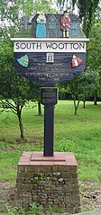
South Wootton village sign - geograph.org.uk - 251366.jpg 382 × 640; 99 KB