Category:Rathdowney
Jump to navigation
Jump to search
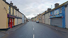
English: Rathdowney (Ráth Domhnaigh in Irish) is a town in southwest County Laois, Ireland. It lies some 32 km southwest of Portlaoise in the Irish midlands, at the point where the R433 regional road from Abbeyleix to Templemore is crossed by the R435 from Borris-in-Ossory to Johnstown.
Svenska: Rathdowney ( iriska: Ráth Domhnaigh) är ett samhälle i sydvästra Laois i Republiken Irland, beläget söder om Portlaoise. Rathdowney ligger belägen där vägarna R433 och R435 möter varandra tillsammans med mindre vägar.
townland in Rathdowney, County Laois, Ireland  | |||||
| Upload media | |||||
| Instance of | |||||
|---|---|---|---|---|---|
| Location | County Laois, Leinster, Ireland | ||||
| Elevation above sea level |
| ||||
| Different from | |||||
 | |||||
Media in category "Rathdowney"
The following 7 files are in this category, out of 7 total.
-
Group of people standing in front of the Rathdowney Hotel (14429400300).jpg 1,000 × 703; 211 KB
-
Queen competition, Rathdowney, ca. 1930 (8872996659).jpg 1,000 × 680; 194 KB
-
Rathdowney Panorama (Church St, Ossory St, Main St).jpg 9,456 × 3,120; 6.71 MB
-
Rathdowney, Co. Laois, Ireland (View of Main Street).jpg 5,312 × 2,988; 3.92 MB
-
Rathdowney, County Laois - geograph.org.uk - 1815554.jpg 3,888 × 2,592; 5.18 MB
-
The Square, Rathdowney, Co. Laois, 1990 (8166240360).jpg 2,000 × 1,311; 2.54 MB
-
The Square, Rathdowney, Co. Laois, circa 1900 (8166240548).jpg 2,000 × 1,532; 1.66 MB