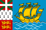
Saint-Pierre, Saint Pierre and Miquelon
Saint-Pierre | |
|---|---|
 Aerial view of Saint-Pierre | |
 | |
| Coordinates: 46°46′40″N 56°10′40″W / 46.7778°N 56.1778°W | |
| Country | France |
| Overseas collectivity | Saint Pierre and Miquelon |
| Government | |
| • Mayor (2014-2020) | Karine Claireaux (PS) |
| Area 1 | 25 km2 (10 sq mi) |
| Population (July 2011) | 5,888 |
| • Density | 240/km2 (610/sq mi) |
| Time zone | UTC−03:00 |
| • Summer (DST) | UTC−02:00 |
| INSEE/Postal code | 97502 /97500 |
| Elevation | 0–207 m (0–679 ft) |
| 1 French Land Register data, which excludes lakes, ponds, glaciers > 1 km2 (0.386 sq mi or 247 acres) and river estuaries. | |
Saint-Pierre is the capital of the French overseas collectivity of Saint Pierre and Miquelon, off the coast of Newfoundland in Canada. Saint-Pierre is the more populated of the two communes (municipalities) making up Saint Pierre and Miquelon.
Geography
The commune of Saint-Pierre is made up of the island of Saint-Pierre proper and several nearby smaller islands, such as L'Île-aux-Marins. Although containing nearly 90% of the inhabitants of Saint Pierre and Miquelon, the commune of Saint-Pierre is considerably smaller than the commune of Miquelon-Langlade, which lies to its northwest on Miquelon Island.
The main settlement and communal seat is situated on the north side of a harbour called Barachois, which faces the Atlantic Ocean, on the Saint-Pierre Island's east coast. The mouth of the harbour is guarded by a small chain of islands.
History
St. Pierre was an outpost used by Al Capone to transport alcohol from Canada to the United States during Prohibition.
Until 1945, there existed a third commune in Saint Pierre and Miquelon: L'Île-aux-Marins. The commune of L'Île-aux-Marins was annexed by the commune of Saint-Pierre in 1945.
Demographics
The population of Saint-Pierre at the 2006 local census was 5,888,[1] many of whom are of Basque, Breton, Normand or Acadian descent. All inhabitants in the commune (municipality) live on the island of Saint-Pierre proper.
Government
The commune is led by a mayor and a council.


Landmarks
Close to the centre of the harbour's edge lie the Post office and Custom House (staffed by Directorate-General of Customs and Indirect Taxes), behind which is General Charles de Gaulle Square, the town's centre.
Other prominent landmarks in Saint-Pierre include the cathedral, to the north of the square, rebuilt in the early twentieth century after a major fire, and the Pointe aux Canons Lighthouse, at the mouth of the harbour. Further north, close to the town's former hospital, is the Fronton Zazpiak Bat - an arena for the traditional Basque sport of pelota.
-
General Charles de Gaulle Square
-
Pointe aux Canons Lighthouse in Saint Pierre
-
Fronton Zazpiak Bat arena in Saint-Pierre
Services
Hospitalier François Dunan (opened 2011[2]) is the only hospital (84 bed facility) in St. Pierre et Miquelon with additional health care needs at the seniors residence at Maison de Retraite Eglantine.
Transportation
Saint-Pierre Airport, the international airport of Saint-Pierre and Miquelon, is located south of the settlement of Saint-Pierre and is served by Air Saint-Pierre with flights both to Miquelon Airport, five Canadian airports and seasonal service to Paris, France.
Radio and television
- Radio France Outremer
- Radio Atlantique
Education
Public primary schools in the commune:
- Ecole maternelle Ile aux Enfants (preschool/nursery) - As of 2014 it had 62 students.[3]
- Ecole primaire Henriette Bonin - As of 2014 it had 62 students[4]
- Ecole élémentaire du Feu Rouge - As of 2014 it had 163 students[5] As of 2016 it had 172 students.[6] It is in the downtown and is one nautical cable from the Ile aux Enfants nursery.[7]
Lycée-Collège d'État Émile Letournel is the public secondary school in the commune, with junior high, vocational high, and general senior high/sixth-form programmes.
Private schools:
- Ecole maternelle Saint-Louis de Gonzague (preschool/nursery)[8]
- Ecole élémentaire Sainte-Croisine - It opened on November 4, 1925[9]
- Ecole élémentaire Sainte-Odile[10]
- Collège Saint Christophe (junior high school)[11]
Twin towns – sister cities
Saint-Pierre is twinned with:
Port-en-Bessin-Huppain, (France), since 1976.[12]
See also
References
- ^ Insee - Bases de donnees - Les resultats des recensements de la population
- ^ http://www.tlr-associes.com/nos-projets__17_sante_hopitaux-et-cliniques_centre-hospitalier-francois-dunan-saint-pierre-et-miquelon_79.html
- ^ "Ecole maternelle Ile aux Enfants > Présentation." National Education Service of Saint Pierre and Miquelon. Retrieved on September 14, 2016.
- ^ "Ecole primaire Henriette Bonin >Présentation." National Education Service of Saint Pierre and Miquelon. Retrieved on September 14, 2016.
- ^ "Ecole élémentaire du Feu Rouge >Présentation." National Education Service of Saint Pierre and Miquelon. Retrieved on September 14, 2016.
- ^ "172 élèves. Evaluation en CE2." Ecole élémentaire du Feu Rouge. Retrieved on September 14, 2016.
- ^ "Contact." Ecole élémentaire du Feu Rouge. Retrieved on September 14, 2016. "L'école élémentaire du Feu Rouge est située au centre-ville de Saint-Pierre à une encablure de l'école maternelle l'Ile aux Enfants." Address: "Ecole élémentaire du Feu Rouge 28, rue Louis Pasteur, BP 4234 St Pierre et Miquelon, 97500 "
- ^ "Ecole maternelle Saint-Louis de Gonzague." National Education Service of Saint Pierre and Miquelon. Retrieved on September 14, 2016.
- ^ "Petit historique." Ecole élémentaire Sainte-Croisine. Retrieved on September 14, 2016.
- ^ Home. Ecole élémentaire Sainte-Odile. Retrieved on September 14, 2016.
- ^ Home. Collège Saint Christophe. Retrieved on September 14, 2016.
- ^ Jumelages


