Sabrina Island (Antarctica): Difference between revisions
maps |
m Bot: link syntax |
||
| (52 intermediate revisions by 34 users not shown) | |||
| Line 1: | Line 1: | ||
{{ |
{{See also|Sabrina Island (Azores)}} |
||
{{Use dmy dates|date=July 2019}} |
|||
[[Image:LocationBalleny.png|thumb|right|Location of the Balleny Islands]] |
|||
{{Infobox islands |
|||
[[Image:Balleny Map.jpg|thumb|right|Sabina Island is just south of Buckle Island]] |
|||
| name = Sabrina Island |
|||
'''Sabrina Island''' is the largest of three small islets lying 1 [[mile]] [[south|southward]] of [[Buckle Island]] in the [[Balleny Islands]]. Sabrina Island is located at {{coor d|66.95|S|163.28|E|}}. Sabrina Island was named after the cutter [[Balleny]]'s schooner, the [[Eliza Scott]], when the Balleny Islands were discovered in [[1839]]. |
|||
| image_name = Sabrina Island monolith.jpg |
|||
| image_caption = Sabrina Island monolith |
|||
| map = Antarctica |
|||
| map_caption = Location in Antarctica |
|||
| nickname = |
|||
| location = [[Antarctica]] |
|||
| coordinates = {{Coord|66|57|S|163|17|E|display=inline,title}} |
|||
| archipelago = [[Balleny Islands]] |
|||
| total_islands = |
|||
| major_islands = |
|||
| area_km2 = |
|||
| length_km = |
|||
| width_km = |
|||
| highest_mount = |
|||
| elevation_m = |
|||
| population = Uninhabited |
|||
| population_as_of = |
|||
| density_km2 = |
|||
| ethnic_groups = |
|||
| country = None |
|||
| treaty_system = [[Antarctic Treaty System]] |
|||
}} |
|||
'''Sabrina Island''' is the largest of three small islets lying {{convert|1.5|km|abbr=on}} [[south]] of [[Buckle Island]] in the [[Balleny Islands]] of [[Antarctica]] and are part of [[New Zealand]]'s [[Ross Dependency]]. |
|||
| ⚫ | |||
{{NZ-geo-stub}} |
|||
== History == |
|||
[[Category:New Zealand and the Antarctic]] |
|||
Sabrina Island was named after Thomas Freeman's cutter when [[John Balleny]]'s squadron discovered the islands in 1839. A pair of islets called [[The Monolith (islands)|The Monolith]] are located off of the island's southern tip. The Fifth [[French Antarctic Expedition]] led by Frank Liotard landed there on 3 March 1949, but could spend only a few hours ashore.<ref>{{Cite book|author1=Pierre Dubard |author2=Luc-Marie Bayle |title=Le "Charcot" et la Terre Adélie |language=fr |place=Paris |publisher=Éditions France Empire |year=1951 |pages=120-122}}</ref> |
|||
| ⚫ | |||
| ⚫ | |||
==Birds== |
|||
The island has outstanding environmental and scientific value as a representative sample of the Balleny Islands – the only oceanic archipelago located within the main Antarctic Coastal Current. It is a breeding site for [[Chinstrap penguin|chinstrap]] and [[Adélie penguin]]s as well as [[Cape petrel]]s. The site is protected under the [[Antarctic Treaty System]] as [[Antarctic Specially Protected Area]] (ASPA) No.104.<ref name=ats>{{cite web |url=http://www.ats.aq/documents/recatt/Att421_e.pdf|title=Sabrina Island, Northern Ross Sea, Antarctica|access-date=2013-01-24 |work=Management Plan for Antarctic Specially Protected Area No. 104: Measure 3, Annex |publisher=Antarctic Treaty Secretariat |year=2009 }}</ref> |
|||
== See also == |
|||
* [[List of Antarctic and subantarctic islands]] |
|||
==References== |
|||
{{reflist}} |
|||
{{Antarctic Specially Protected Areas}} |
|||
| ⚫ | |||
[[Category:Antarctic Specially Protected Areas]] |
|||
| ⚫ | |||
[[Category:Penguin colonies]] |
|||
| ⚫ | |||
Latest revision as of 06:12, 12 November 2023
 Sabrina Island monolith | |
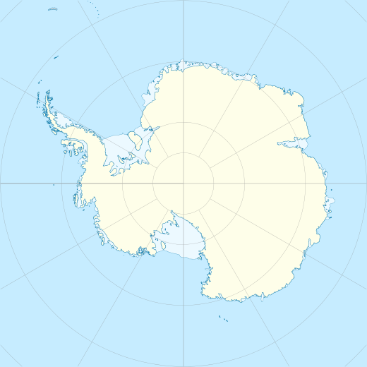 Sabrina Island Location in Antarctica | |
| Geography | |
|---|---|
| Location | Antarctica |
| Coordinates | 66°57′S 163°17′E / 66.950°S 163.283°E |
| Archipelago | Balleny Islands |
| Administration | |
| Administered under the Antarctic Treaty System | |
| Demographics | |
| Population | Uninhabited |
Sabrina Island is the largest of three small islets lying 1.5 km (0.93 mi) south of Buckle Island in the Balleny Islands of Antarctica and are part of New Zealand's Ross Dependency.
History[edit]
Sabrina Island was named after Thomas Freeman's cutter when John Balleny's squadron discovered the islands in 1839. A pair of islets called The Monolith are located off of the island's southern tip. The Fifth French Antarctic Expedition led by Frank Liotard landed there on 3 March 1949, but could spend only a few hours ashore.[1]
Birds[edit]
The island has outstanding environmental and scientific value as a representative sample of the Balleny Islands – the only oceanic archipelago located within the main Antarctic Coastal Current. It is a breeding site for chinstrap and Adélie penguins as well as Cape petrels. The site is protected under the Antarctic Treaty System as Antarctic Specially Protected Area (ASPA) No.104.[2]
See also[edit]
References[edit]
- ^ Pierre Dubard; Luc-Marie Bayle (1951). Le "Charcot" et la Terre Adélie (in French). Paris: Éditions France Empire. pp. 120–122.
- ^ "Sabrina Island, Northern Ross Sea, Antarctica" (PDF). Management Plan for Antarctic Specially Protected Area No. 104: Measure 3, Annex. Antarctic Treaty Secretariat. 2009. Retrieved 24 January 2013.
This article about the geography of New Zealand's outlying islands is a stub. You can help Wikipedia by expanding it. |