Summit County, Colorado
Summit County | |
|---|---|
 Summit County court house in Breckenridge | |
 Seal | |
 Location within the U.S. state of Colorado | |
 Colorado's location within the U.S. | |
| Coordinates: 39°38′08″N 106°06′08″W / 39.6356°N 106.10235°W | |
| Country | |
| State | |
| Founded | November 1, 1861 |
| Named for | Continental Divide |
| Seat | Breckenridge |
| Largest town | Breckenridge |
| Area | |
| • Total | 619 sq mi (1,600 km2) |
| • Land | 608 sq mi (1,570 km2) |
| • Water | 11 sq mi (30 km2) 1.8% |
| Population (2010) | |
| • Total | 27,994 |
| • Density | 46/sq mi (18/km2) |
| Time zone | UTC−7 (Mountain) |
| • Summer (DST) | UTC−6 (MDT) |
| Congressional district | 2nd |
| Website | www |
Summit County is one of the 64 counties in the U.S. state of Colorado. As of the 2010 census, the population was 27,994.[1] The county seat is Breckenridge.Template:GR
Summit County comprises the Breckenridge, CO Micropolitan Statistical Area.[2][3]
History
Summit County was organized as one of the seventeen original Colorado counties by the First Territorial Legislature on November 1, 1861. It was named for the many mountain summits in the county. Until February 2, 1874, its boundaries included the area now comprising Summit County, Grand County, Routt County, Moffat County, Garfield County, Eagle County, and Rio Blanco County.
In 1874, the northern half of the original Summit County was split off to form Grand County; with the creation of Garfield and Eagle counties in 1883, Summit County arrived at its present boundaries. In addition, Summit County has seen two major boom eras.
Geography
According to the U.S. Census Bureau, the county has a total area of 619 square miles (1,600 km2), of which 608 square miles (1,570 km2) is land and 11 square miles (28 km2) (1.8%) is water.Template:GR
Adjacent counties
- Grand County - north
- Clear Creek County - east
- Park County - southeast
- Lake County - southwest
- Eagle County - west
Demographics
| Census | Pop. | Note | %± |
|---|---|---|---|
| 1870 | 258 | — | |
| 1880 | 5,459 | 2,015.9% | |
| 1890 | 1,906 | −65.1% | |
| 1900 | 2,744 | 44.0% | |
| 1910 | 2,003 | −27.0% | |
| 1920 | 1,724 | −13.9% | |
| 1930 | 987 | −42.7% | |
| 1940 | 1,754 | 77.7% | |
| 1950 | 1,135 | −35.3% | |
| 1960 | 2,073 | 82.6% | |
| 1970 | 2,665 | 28.6% | |
| 1980 | 8,848 | 232.0% | |
| 1990 | 12,281 | 38.8% | |
| 2000 | 23,548 | 91.7% | |
| 2010 | 27,994 | 18.9% | |
| 2013 (est.) | 28,649 | 2.3% | |
1790-1960[5] 1900-1990[6] 1990-2000[7] 2010-2013[1] | |||
As of the censusTemplate:GR of 2000, there were 23,548 people, 9,120 households, and 4,769 families residing in the county. The population density was 39 people per square mile (15/km²). There were 24,201 housing units at an average density of 40 per square mile (15/km²). The racial makeup of the county was 91.84% White, 0.68% Black or African American, 0.48% Native American, 0.87% Asian, 0.07% Pacific Islander, 3.96% from other races, and 2.10% from two or more races. 9.79% of the population were Hispanic or Latino of any race.
There were 9,120 households out of which 24.00% had children under the age of 18 living with them, 44.00% were married couples living together, 4.40% had a female householder with no husband present, and 47.70% were non-families. 21.60% of all households were made up of individuals and 1.60% had someone living alone who was 65 years of age or older. The average household size was 2.48 and the average family size was 2.86.
In the county the population was spread out with 17.40% under the age of 18, 15.70% from 18 to 24, 44.30% from 25 to 44, 19.40% from 45 to 64, and 3.30% who were 65 years of age or older. The median age was 31 years. For every 100 females there were 139.00 males. For every 100 females age 18 and over, there were 144.90 males.
The median income for a household in the county was $56,587, and the median income for a family was $66,914 (these figures had risen to $65,281 and $80,441 respectively as of a 2007 estimate[8]). Males had a median income of $33,741 versus $27,017 for females. The per capita income for the county was $28,676. About 3.10% of families and 9.00% of the population were below the poverty line, including 4.30% of those under age 18 and 3.40% of those age 65 or over.
The 2012 average real estate prices in Summit County were $708,660 for a single family home, $359,536 for a condo, townhome or duplex and $281,388 for a vacant piece of land (YTD through August 2012).[9]
Communities
Recreation
National protected areas
Ski areas
Trails and byways
- American Discovery Trail
- Colorado Trail
- Continental Divide National Scenic Trail
- Great Parks Bicycle Route
- Top of the Rockies National Scenic Byway
- TransAmerica Trail Bicycle Route
- Vail Pass National Recreation Trail
- Wheeler Ten Mile National Recreation Trail
Lakes
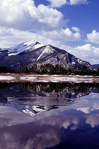
The county has two reservoirs, Lake Dillon and Green Mountain Reservoir, that are also popular recreation sites.
See also
- Outline of Colorado
- Index of Colorado-related articles
- National Register of Historic Places listings in Summit County, Colorado
- Silverthorne Micropolitan Statistical Area
References

- ^ a b "State & County QuickFacts". United States Census Bureau. Retrieved June 11, 2014.
- ^ "OMB Bulletin No. 10-02: Update of Statistical Area Definitions and Guidance on Their Uses" (PDF). United States Office of Management and Budget. December 1, 2009. Retrieved April 19, 2012.
- ^ See the Colorado census statistical areas.
- ^ "U.S. Decennial Census". United States Census Bureau. Retrieved June 11, 2014.
- ^ "Historical Census Browser". University of Virginia Library. Retrieved June 11, 2014.
- ^ "Population of Counties by Decennial Census: 1900 to 1990". United States Census Bureau. Retrieved June 11, 2014.
- ^ "Census 2000 PHC-T-4. Ranking Tables for Counties: 1990 and 2000" (PDF). United States Census Bureau. Retrieved June 11, 2014.
- ^ factfinder.census.gov
- ^
Brewer, Brewer (2012-09-27). "Summit County Real Estate". Team-Brewer Market Trends. Ben Brewer. Retrieved 2012-09-27.
{{cite web}}: Unknown parameter|coauthors=ignored (|author=suggested) (help)
External links
- Official website
- Colorado County Evolution by Don Stanwyck
- Colorado Historical Society
- Kokomo and Racen ghost towns
39°30′N 106°03′W / 39.50°N 106.05°W
Places adjacent to Summit County, Colorado | ||||||||||||||||
|---|---|---|---|---|---|---|---|---|---|---|---|---|---|---|---|---|
| ||||||||||||||||
Municipalities and communities of Summit County, Colorado, United States | ||
|---|---|---|
| Towns |  | |
| CDPs | ||
| Ghost towns |
| |