Herzogstand: Difference between revisions
Scriberius (talk | contribs) m added Category:Bad Tölz-Wolfratshausen using HotCat |
|||
| Line 22: | Line 22: | ||
The '''Herzogstand''' is a mountain in the [[Bavaria|Bavarian]] foothills of the [[Alps]], {{convert|75|km}} south of the city of [[Munich]]. It has an elevation of {{convert|1731|m}} and is northwest of [[Walchensee|Lake Walchen]]. [[Maximilian II of Bavaria]] had a hunting lodge built underneath today's so-called ''Herzogstand-house'' in 1857. His successor, [[Ludwig II of Bavaria|King Ludwig II]], had a royal lodge built further up the mountain in 1865. The [[Herzogstand Aerial Tramway]], renewed in 1994 following a fire in 1992, runs to Herzogstand-house at {{convert|1575|m}} above sea level, and then continues on to the summit of Farnkopf at {{convert|1627|m}}. |
The '''Herzogstand''' is a mountain in the [[Bavaria|Bavarian]] foothills of the [[Alps]], {{convert|75|km}} south of the city of [[Munich]]. It has an elevation of {{convert|1731|m}} and is northwest of [[Walchensee|Lake Walchen]]. [[Maximilian II of Bavaria]] had a hunting lodge built underneath today's so-called ''Herzogstand-house'' in 1857. His successor, [[Ludwig II of Bavaria|King Ludwig II]], had a royal lodge built further up the mountain in 1865. The [[Herzogstand Aerial Tramway]], renewed in 1994 following a fire in 1992, runs to Herzogstand-house at {{convert|1575|m}} above sea level, and then continues on to the summit of Farnkopf at {{convert|1627|m}}. |
||
Because of its nearness, the Herzogstand is considered to be Munich's "house mountain" and is used for recreational purposes by its residents. |
<!-- Because of its nearness, the Herzogstand is considered to be Munich's "house mountain" and is used for recreational purposes by its residents. Brauneck?--> |
||
The most popular ascent (AV way 446) leads from the valley station of the [[aerial tramway]] across the south side to Herzogstand-house and on to the summit of the mountain. An alternative descent leads along the somewhat exposed but well-secured [[ridge]] to the [[Heimgarten (mountain)|Heimgarten]] mountain ({{convert|1790|m|ft|disp=x|/}}), passing a lodge to the south of the Ohlstaedter Alm ({{convert|1423|m|ft|disp=x|/}}). The descent east of the [[Rotwandkopf]] continues down to the spa town of [[Walchensee, Kochel|Walchensee]]. |
The most popular ascent (AV way 446) leads from the valley station of the [[aerial tramway]] across the south side to Herzogstand-house and on to the summit of the mountain. An alternative descent leads along the somewhat exposed but well-secured [[ridge]] to the [[Heimgarten (mountain)|Heimgarten]] mountain ({{convert|1790|m|ft|disp=x|/}}), passing a lodge to the south of the Ohlstaedter Alm ({{convert|1423|m|ft|disp=x|/}}). The descent east of the [[Rotwandkopf]] continues down to the spa town of [[Walchensee, Kochel|Walchensee]]. |
||
| Line 59: | Line 59: | ||
[[Category:One-thousanders]] |
[[Category:One-thousanders]] |
||
[[Category:Bavarian Prealps]] |
[[Category:Bavarian Prealps]] |
||
[[Category:Bad Tölz-Wolfratshausen]] |
|||
Revision as of 03:36, 30 December 2014
| Herzogstand | |
|---|---|
 Herzogstand from Heimgarten | |
| Highest point | |
| Elevation | 1,731 m (5,679 ft) |
| Geography | |
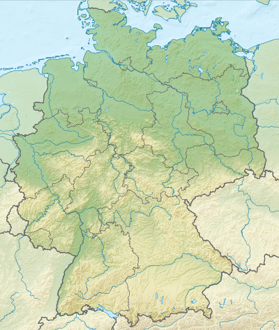 Herzogstand Location of Herzogstand in Germany | |
| Location | Bavaria, Germany |
| Parent range | Bavarian Prealps |
The Herzogstand is a mountain in the Bavarian foothills of the Alps, 75 kilometres (47 mi) south of the city of Munich. It has an elevation of 1,731 metres (5,679 ft) and is northwest of Lake Walchen. Maximilian II of Bavaria had a hunting lodge built underneath today's so-called Herzogstand-house in 1857. His successor, King Ludwig II, had a royal lodge built further up the mountain in 1865. The Herzogstand Aerial Tramway, renewed in 1994 following a fire in 1992, runs to Herzogstand-house at 1,575 metres (5,167 ft) above sea level, and then continues on to the summit of Farnkopf at 1,627 metres (5,338 ft).
The most popular ascent (AV way 446) leads from the valley station of the aerial tramway across the south side to Herzogstand-house and on to the summit of the mountain. An alternative descent leads along the somewhat exposed but well-secured ridge to the Heimgarten mountain (1,790 metres/5,870 ft), passing a lodge to the south of the Ohlstaedter Alm (1,423 metres/4,669 ft). The descent east of the Rotwandkopf continues down to the spa town of Walchensee.
Transmitter
The summit of Herzogstand has been used since 1920 for radiotechnical purposes when a VLF transmission antenna was erected between 1920 and 1934. Today, a transmission facility for FM radio exists on Fahrenbergkopf which is used for transmitting the following stations:
| Frequency | Program | ERP |
|---|---|---|
| 88.1 MHz | Bayern 1 (Reg. Obb.) | 0,1 kW |
| 91.0 MHz | Bayern 3 | 0,1 kW |
| 97.0 MHz | Bayern 2 (Reg. Obb.) | 0,1 kW |
| 99.9 MHz | Radio Alpenwelle | 0,1 kW |
| 102.0 MHz | Antenne Bayern | 0,1 kW |
| 104.1 MHz | 4 Klassik | 0,1 kW |
| 104.6 MHz | Radio Oberland | 0,1 kW |
| 106.7 MHz | B 5 aktuell | 0,1 kW |