Hanover Township, Allamakee County, Iowa
Hanover Township, Allamakee County | |
|---|---|
 | |
| Coordinates: 43°23′09″N 091°33′02″W / 43.38583°N 91.55056°W | |
| Country | |
| State | |
| County | Allamakee |
| Area | |
| • Total | 35.96 sq mi (93.14 km2) |
| • Land | 35.93 sq mi (93.07 km2) |
| • Water | 0.03 sq mi (0.07 km2) |
| Elevation | 827 ft (252 m) |
| Population (2010) | |
| • Total | 193 |
| • Density | 5.4/sq mi (2.1/km2) |
| Time zone | UTC-6 (CST) |
| • Summer (DST) | UTC-5 (CDT) |
| FIPS code | 19-91824[2] |
| GNIS feature ID | 0467998 |
Hanover Township is one of eighteen townships in Allamakee County, Iowa, USA. At the 2010 census, its population was 193.[3]
History
Hanover Township was organized in 1855.[4]
Geography
Hanover Township covers an area of 35.96 square miles (93.1 km2) and contains no incorporated settlements. According to the USGS, it contains three cemeteries: Iowa River, O'Hare Place and Saint Patricks.
References
- ^ "US Board on Geographic Names". United States Geological Survey. October 25, 2007. Retrieved January 31, 2008.
- ^ "U.S. Census website". United States Census Bureau. Retrieved January 31, 2008.
- ^ "IA - Hanover township". United States Census Bureau. Archived from the original on April 9, 2013. Retrieved March 17, 2013.
- ^ Hancock, Ellery M. (1913). Past and Present of Allamakee County, Iowa: A Record of Settlement, Organization, Progress and Achievement, Volume 1. S. J. Clarke publishing Company. p. 227.
External links
Municipalities and communities of Allamakee County, Iowa, United States | ||
|---|---|---|
| Cities | 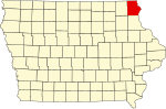 | |
| Townships | ||
| Unincorporated communities | ||
| Footnotes | ‡This populated place also has portions in an adjacent county or counties | |
This article about the geography of Allamakee County, Iowa is a stub. You can help Wikipedia by expanding it. |