Gori Municipality: Difference between revisions
Content deleted Content added
No edit summary |
remove unused div col |
||
| Line 51: | Line 51: | ||
* Shindisi |
* Shindisi |
||
* Dzevera |
* Dzevera |
||
* Khidistavi |
* Khidistavi |
||
=== Villages === |
=== Villages === |
||
Revision as of 13:56, 18 April 2020
| Gori Municipality (Georgia) | |
|---|---|
| |
| General information | |
| Area: | 2,320 km² |
| Population: | 150,000 |
| Subdivision: | 2 cities, 143 villages |
| Regional center: | Gori |
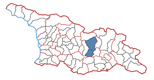
Gori (Georgian: გორის მუნიციპალიტეტი, Goris municiṗaliṫeṫi) is a district of Georgia, in the region of Shida Kartli. After abolishment of former South Ossetian Autonomous Oblast, the Gori District included the territory of former Tskhinvali District. Some northern territories of the district are part of a self-proclaimed republic of South Ossetia and have not been under control of the Georgian government since 1992.
Administrative divisions
Gori municipality (those parts under de facto Georgian jurisdiction) is divided into 2 city (ქალაქი), 22 communities (თემი), and 143 villages (სოფელი)
Cities
Communities
- Ateni
- Akhalubani
- Berbuki
- Boshuri
- Dici
- Variani
- Zeghduleti
- Karaleti
- Mereti
- Mejvriskhevi
- Mghebriani
- Nikozi
- Saqavre
- Skra
- Tiniskhidi
- Tirdznisi
- Tqviavi
- Kvakhvreli
- Shavshvebi
- Shindisi
- Dzevera
- Khidistavi
Villages
- Ateni
- Tsedisi
- Bnavisi
- Olozi
- Ghvarebi
- Akhalubani
- Kveshi
- Akhrisi
- Adzvi
- Mumlaant Kari
- Jariasheni
- Tsitsagiaant Kari
- Kvemo Artsevi
- Berbuki
See also
References
External links
- Official website of Gori District (Georgian, English)
- Districts of Georgia, Statoids.com
| Autonomous Republic of Abkhazia | |
|---|---|
| Autonomous Republic of Adjara | |
| Guria | |
| Imereti | |
| Kakheti | |
| Mtskheta-Mtianeti | |
| Racha-Lechkhumi and Kvemo Svaneti | |
| Samegrelo-Zemo Svaneti | |
| Samtskhe-Javakheti | |
| Kvemo Kartli | |
| Shida Kartli | |
41°58′00″N 44°06′00″E / 41.9667°N 44.1000°E
This Georgia location article is a stub. You can help Wikipedia by expanding it. |