Mission River, Queensland: Difference between revisions
m add category |
updating 2021 census |
||
| (12 intermediate revisions by 6 users not shown) | |||
| Line 8: | Line 8: | ||
| image = |
| image = |
||
| caption = |
| caption = |
||
| coordinates = {{coord|-12.6627|141.9877|type:city_region:AU-QLD|display=inline,title|name=Mission River (centre of locality)}} |
|||
| pop = |
| pop = 974 |
||
| pop_year = |
| pop_year = {{CensusAU|2021}} |
||
| pop_footnotes = |
| pop_footnotes = <ref name=Census2021/> |
||
| established = |
| established = |
||
| postcode = 4874 |
| postcode = 4874 |
||
| area = |
| area = 5603.5 <!-- 3623.2 for Cook + 1980.3 for Napranum --> |
||
| |
| timezone = [[AEST]] |
||
| |
| utc = +10:00 |
||
| dist1 = 11.8 <!-- road distances as per template instructions --> |
|||
| ⚫ | |||
| |
| dir1 = SE |
||
| |
| location1 = [[Weipa]] |
||
| |
| dist2 = 642 |
||
| |
| dir2 = NW |
||
| |
| location2 = [[Cooktown, Queensland|Cooktown]] |
||
| |
| dist3 = 811 |
||
| |
| dir3 = NW |
||
| |
| location3 = [[Cairns]] |
||
| |
| dist4 = 2464 |
||
| ⚫ | |||
| location4 = [[Brisbane]] |
|||
| lga = Shire of Cook |
| lga = Shire of Cook |
||
| lga2 = Aboriginal Shire of Napranum |
| lga2 = Aboriginal Shire of Napranum |
||
| stategov = [[Electoral district of Cook|Cook]] |
| stategov = [[Electoral district of Cook|Cook]] |
||
| fedgov = [[Division of Leichhardt|Leichhardt]] |
| fedgov = [[Division of Leichhardt|Leichhardt]] |
||
| near-n |
| near-n = [[Mapoon, Queensland|Mapoon]] |
||
| near-ne |
| near-ne = [[Wenlock, Queensland|Wenlock]] |
||
| near-e |
| near-e = [[Wenlock, Queensland|Wenlock]] |
||
| near-se |
| near-se = [[Archer River, Queensland|Archer River]] |
||
| near-s |
| near-s = [[Aurukun, Queensland|Aurukun]] |
||
| near-sw |
| near-sw = ''[[Gulf of Carpentaria]]'' |
||
| near-w |
| near-w = ''[[Weipa Town|Weipa & suburbs]]'' |
||
| near-nw |
| near-nw = ''[[Gulf of Carpentaria]]'' |
||
}} |
}} |
||
'''Mission River''' is a coastal [[Suburbs and localities (Australia)|locality]] split between the [[Shire of Cook]] and the [[Aboriginal Shire of Napranum]] in [[Queensland]], Australia.<ref name=qpnl>{{cite QPN|45794|Mission River|locality in Shire of Cook|accessdate=29 December 2017}}</ref> |
'''Mission River''' is a coastal rural [[Suburbs and localities (Australia)|locality]] split between the [[Shire of Cook]] and the [[Aboriginal Shire of Napranum]] in [[Queensland]], Australia.<ref name=qpnl>{{cite QPN|45794|Mission River|locality in Shire of Cook|accessdate=29 December 2017}}</ref> In the {{CensusAU|2021}}, Mission River had a population of 974 people.<ref name=Census2021/> |
||
== Geography == |
== Geography == |
||
Within Mission River are the [[Enclave and exclave|enclaves]] of [[Evans Landing, Queensland|Evans Landing]], [[Nanum, Queensland|Nanum]], [[Rocky Point, Queensland (Weipa Town)|Rocky Point]], [[Trunding, Queensland|Trunding]], and [[Weipa Airport]], all of which are part of [[Weipa Town]].<ref name="globe">{{Queensland Globe|accessdate= |
Within Mission River are the [[Enclave and exclave|enclaves]] of [[Evans Landing, Queensland|Evans Landing]], [[Nanum, Queensland|Nanum]], [[Rocky Point, Queensland (Weipa Town)|Rocky Point]], [[Trunding, Queensland|Trunding]], and [[Weipa Airport]], all of which are part of [[Weipa Town]].<ref name="globe">{{Queensland Globe|accessdate=|access-date=14 January 2021}}</ref> |
||
== History == |
== History == |
||
''[[Linngithigh dialect|Linngithigh]]'' (also known as ''Winda Winda'' and ''Linginiti'') an [[Australian Aboriginal language]] spoken by the Linngithigh people. The Linngithigh language region includes landscape within the local government boundaries of the [[Shire of Cook|Cook Shire Council]]: [[Cape York Peninsula|Western Cape York]], Winda Winda Creek, Mission River, and [[Archer River, Queensland|Archer River]].<ref>{{Cite web|url=https://maps.slq.qld.gov.au/iyil/view/95?embed=true|title=Linngithigh|last=|first=|date=|website=State Library of Queensland|url-status=live|archive-url=https://web.archive.org/web/20210423091733/https://maps.slq.qld.gov.au/iyil/view/95?embed=true|archive-date=23 April 2021|access-date=30 January 2020}}</ref> |
|||
| ⚫ | |||
[[Thaynakwith]] (also known as Awngthim, Tainikuit and Winduwinda) is an [[Australian Aboriginal language]] spoken on Western Cape York in the Weipa area taking in Albatross Bay and Mission River. The language region includes areas within the local government boundaries of Weipa Town Council and [[Shire of Cook|Cook Shire]].<ref>{{Cite SLQ-CC-BY|url=https://maps.slq.qld.gov.au/iyil/view/129?embed=true|title=Thaynakwith|author=|date=|website=Queensland’s Aboriginal and Torres Strait Islander Languages map|access-date=5 February 2020}}</ref> |
|||
| ⚫ | |||
== Demographics == |
|||
In the {{CensusAU|2016}}, Mission River had a population of 987 people.<ref name=Census2016>{{Census 2016 AUS|id=SSC31880|name=Mission River (SSC)|accessdate=20 October 2018|quick=on}}</ref> |
|||
In the {{CensusAU|2021}}, Mission River had a population of 974 people.<ref name=Census2021>{{Census 2021 AUS|id=SAL31864|name=Mission River (SAL)|access-date=28 February 2023|quick=on}}</ref> |
|||
== Education == |
|||
There are no schools in Mission River. The nearest primary and secondary school is Western Cape State College in [[Rocky Point, Queensland (Weipa Town)|Rocky Point]] in [[Weipa]].<ref name="globe" /> |
|||
== References == |
== References == |
||
{{reflist}} |
{{reflist}} |
||
{{Shire of Cook}}{{Aboriginal Shire of Napranum}} |
{{Shire of Cook}} |
||
{{Aboriginal Shire of Napranum}} |
|||
[[Category:Shire of Cook]] |
[[Category:Shire of Cook]] |
||
| Line 57: | Line 72: | ||
[[Category:Coastline of Queensland]] |
[[Category:Coastline of Queensland]] |
||
[[Category:Localities in Queensland]] |
[[Category:Localities in Queensland]] |
||
[[Category:Rivers of Queensland]] |
|||
{{Queensland-geo-stub}} |
|||
Latest revision as of 05:41, 27 May 2024
| Mission River Queensland | |||||||||||||||
|---|---|---|---|---|---|---|---|---|---|---|---|---|---|---|---|
 Mission River | |||||||||||||||
| Coordinates | 12°39′46″S 141°59′16″E / 12.6627°S 141.9877°E | ||||||||||||||
| Population | 974 (2021 census)[1] | ||||||||||||||
| • Density | 0.17382/km2 (0.45019/sq mi) | ||||||||||||||
| Postcode(s) | 4874 | ||||||||||||||
| Area | 5,603.5 km2 (2,163.5 sq mi) | ||||||||||||||
| Time zone | AEST (UTC+10:00) | ||||||||||||||
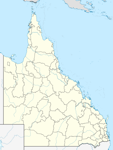
| Location | |||||||||||||||
| LGA(s) | |||||||||||||||
| State electorate(s) | Cook | ||||||||||||||
| Federal division(s) | Leichhardt | ||||||||||||||
| |||||||||||||||
Mission River is a coastal rural locality split between the Shire of Cook and the Aboriginal Shire of Napranum in Queensland, Australia.[2] In the 2021 census, Mission River had a population of 974 people.[1]
Geography[edit]
Within Mission River are the enclaves of Evans Landing, Nanum, Rocky Point, Trunding, and Weipa Airport, all of which are part of Weipa Town.[3]
History[edit]
Linngithigh (also known as Winda Winda and Linginiti) an Australian Aboriginal language spoken by the Linngithigh people. The Linngithigh language region includes landscape within the local government boundaries of the Cook Shire Council: Western Cape York, Winda Winda Creek, Mission River, and Archer River.[4]
Thaynakwith (also known as Awngthim, Tainikuit and Winduwinda) is an Australian Aboriginal language spoken on Western Cape York in the Weipa area taking in Albatross Bay and Mission River. The language region includes areas within the local government boundaries of Weipa Town Council and Cook Shire.[5]
The locality was probably named during 1895 by missionary J. Nicholas Hey and administrator John Douglas (Government Resident of Thursday Island from 1885 to 1904).[2]
Demographics[edit]
In the 2016 census, Mission River had a population of 987 people.[6]
In the 2021 census, Mission River had a population of 974 people.[1]
Education[edit]
There are no schools in Mission River. The nearest primary and secondary school is Western Cape State College in Rocky Point in Weipa.[3]
References[edit]
- ^ a b c Australian Bureau of Statistics (28 June 2022). "Mission River (SAL)". 2021 Census QuickStats. Retrieved 28 February 2023.
- ^ a b "Mission River – locality in Shire of Cook (entry 45794)". Queensland Place Names. Queensland Government. Retrieved 29 December 2017.
- ^ a b "Queensland Globe". State of Queensland. Retrieved 14 January 2021.
- ^ "Linngithigh". State Library of Queensland. Archived from the original on 23 April 2021. Retrieved 30 January 2020.
- ^
This Wikipedia article incorporates CC-BY-4.0 licensed text from: "Thaynakwith". Queensland’s Aboriginal and Torres Strait Islander Languages map. State Library of Queensland. Retrieved 5 February 2020.
- ^ Australian Bureau of Statistics (27 June 2017). "Mission River (SSC)". 2016 Census QuickStats. Retrieved 20 October 2018.